Poet, Essayist, Photographer, Naturalist

Category: Hike Reports Page 1 of 2

Manorville Hills Spring Hike

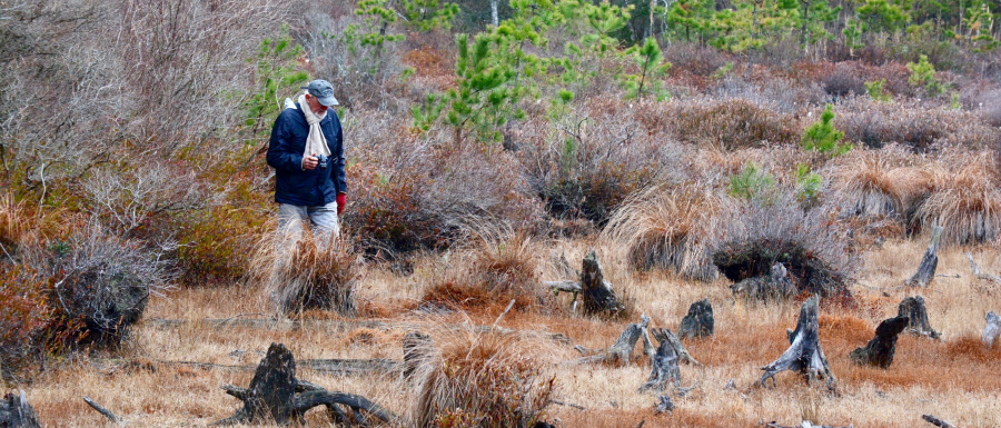
To describe our most recent hike in Manorville Hills County Park, a single word will suffice. FRESH.  Moments after we exited the parking lot and headed toward Trail #5.

Early June, no one in the park but Mark and me. Along with sunshine, we entered the renewal of this Pine Barrens Forest. Fresh new ferns, grasses , mosses, blueberry shrubs,  and the oaks. Gypsy moths were at work. There was evidence on the trails. I found pieces of partially chewed leaves, as well as caterpillars because leaves are fresh and tender.

A Fabulous Greenbelt Walk- Part 1

A late May walk is memorable for several reasons. Much of the landscape is vegetation with crisp, new leaves, not yet eaten by insects, many shades of green, and a variety of textures. This is migration time for birds. I was walking in a botanical museum. I am part of the Carls River Corridor.

Warblers were singing in the forest canopy. I decided to walk from Babylon Village up to Belmont Lake State Park and back, six miles total. The trail is wide and slightly elevated. When Southern State Parkway was constructed and Belmont Lake State Park opened, fill was layed down to create a path through an extensive wetland.

The Long Pond Greenbelt – Hike Report

The map I picked up at the Long Pond Greenbelt booth at the Long Island Natural History Conference was enough to convince me that I’ve got to go. Dai Dayton, president of the Friends of the Long Pond Greenbelt has created a fantastic map. Dai generously put me up at her house in 2004 when I traversed the entire Paumanok Path over the Thanksgiving week. I remember the 3 bacon, tomato, and lettuce sandwiches she packed for me that day when I hiked with companion Bob  all the way to Amagansett – 35 miles!

The 800 acre natural area has a total of 16 miles of trails, 13 ponds, two museums, a nature center, and one bench. All the trails are well marked. The map is oriented north-south, colored coded, and with helpful details.  Made of Tyvack, a fibrous plastic material that doesn’t tear and is waterproof, can be folded countless times and holds up nicely. One side is the north section, the other, south. Here is a list of what’s on the map:     houses         roads     trails     water bodies     Sag Harbor boundary          bay to ocean footpath           protected     land        street names       distances          power lines            parking locations              cemetery          two museums         scale                                Long Pond Nature Center    side trails         Paumanok Path                Mashashimuet Park

Bethpage State Park – Hike, April 12, 2017

I parked just outside Bethpage State Park and walked the Nassau  -Suffolk trail north. I came to an entrance road to the polo field and was able to view a lot of green. Cutting left to stay along the edge of the fairways, I viewed the red course with light green greens and darker green fairways, sand traps and the dead stalks of little blue stem grass. Over the forest to the east, a huge hump that looked like a gray whale surfacing. No, it is the Farmingville Landfill. V-shaped water spouts added some drama. Along the hike, I picked up a few balls that had “smiles” from iron shots whose golfers made swings that didn’t make square contact with the ball. One such ball, embedded in dirt attracted my attention. I edged it out. It had a root coming out from the smile. This was a keeper for sure. I saw the clubhouse and headed up hill in between the boundary of red and black course. I asked for the pro shop in order to get a map. “You’re not allowed anywhere on the golf course.” I was holding my walking staffs, a dead giveaway. I headed along the edge of the yellow course looking for an exit. I stepped through an opening in the chain link fence and found myself back on the white blazed trail that I started on. I marveled at the abundance of acorns along the edges.

Snow Hike -“The Hills”

It’s my oasis. I come to the “Hills” to escape the computer in my office. I come to experience the largest, natural, unfenced forest left on Long Island because it’s there. I don’t have to pay. I have only a compass and map. I can bushwack or follow well-marked trails. I am away from cloying noises. I can get lost at random. I have the chance to some upon magnificent boulders that stand out dramatically in a forest of pine/oak trees. I come to be with the lichens which have not diminished as they have further west due to clean air void of sulfur and nitrous oxides which lichens are sensitive to. I came to be with my pal with Mark. my hike companion.

The day was beyond a February thaw. I’d call it a “melt” there was snow cover but it is corn snow mush. I wore the wrong footwear, a pair of sneakers which soaked up water. I had the camera and note pad. Our plan was to walk east on Hot Water Street and turn left on #6. Number 6 is one of the north-south emergency routes that serve if a rescue is necessary. They are wide enough for a four-wheel vehicle. We found snowmobile tracks which helped our footing. My shoes sank into the soft snow.

The Door to the Temple

“For me, the door to the woods is the door to the temple.”

Mary Oliver; Upstream, 2016 p154

Mark parked in the Manorville Hills County Park parking lot, and we set out for a walk in the largest pine forest left on Long Island. Its official name is The Long Island Pine Barrens Forest Preserve. We are in the 50,000 acre core area where no development is permitted. Beyond this, the 50,000 acre compatible growth area allows some growth in cluster zoning. Both areas are a safe deposit box for water. With very little impact from surface infrastructure, the ground water remains clean and pure.

There is no place else where one can wander on forested trails in such a large area. The 35,000 acre core isn’t all in the Manorville Hills, but the next larges area is 5,000 acre Connequoit River State Park Preserve.

Quogue Wildlife Refuge Walk

I hike not so much for the exercise, but for the friendship I have with Mark, and to  use my curiosity of the natural world to discover new things. After 40 years of doing this (now 77) I still find plenty to take note of, learn more from, and write about.

Mark and I explored the trails at Quogue Wildlife Refuge, in Southampton New York, for a few hours. It is a long, narrow area whose boundaries are determined by a fresh water creek that flows through the center and three ponds. We were surrounded by Pine Barrens. When looking beyond the fences of this place, I did’nt see any houses. The fresh water portion of the Quantuck Creek watershed may be one of the cleanest on the south shore. There only three crossings, the Long Island Railroad, South Country Road, and Montauk Highway which spans the estuary on the Great South Bay. Here, the name “country” really means that. Middle and North Country were in country, but not so much today.

Sore Thumb Walk

The sore thumb is an isthmus of sand and scrub on the north side of Fire Island Inlet. It is a favorite beach buggy spot where surf casters fish. On the north side of the thumb, a charming cove with flat water.

I started my walk from the Overlook, a Babylon Town Beach. My plan was a circular…east to the tip of the thumb, then along the sand road to Ocean Parkway, then west back to the Overlook.

Manorville Hills Hike

A “Mack” truck greeted me in the parking lot of the Manorville Hills County Park. Mack is Mark’s pet dog, a look alike for the shiny silver ornaments on trucks of the same name. Mark often takes Mack on his walks. “He can keep up for miles” boasts mark.
We headed out on the Paumanok Path following nice, fresh white rectangular blazes. An overcast sky took the glare away producing a soft, intense green shrub layer, and crusty brown barky trunks of pitch pine and gray of oaks.
We stopped at a meadow to check out one of the five benches I made and brought into the park. A path had been mowed to the bench adding to its charm. The flood of light and opening in the forest prompted Mark to comment “This would be a good place for a house.”

William Floyd Estate – Hike Report

We found ourselves on a trail that parallels the Forge River. Dead low tide produced rivulets of fresh ground water that tricked toward the river. Mark spotted an osprey and a person on the opposite shore with binoculars looking toward the forest edge of the estate.. I heard that a bald eaglewas nesting from an Audubon Newsletter. I had seen an eagle at the Morton Wildlife Refuge a year ago. Sightings are rare. If eagles return to Long Island, as Opsreys have, this is encoruraging. We kept our eyes open.

We came to a trail that was blocked. The sign on the fence said: “Closed. Do not enter.” We knew immediately that the eagle nest was somewhere inside. We obeyed the signs and headed back toward the buildings.
Most of the trail to this point on walk was forested on both sides. However, we encountered changes in scenery as we entered open fields. The fields have been mowed in order to keep them from eventually succeeding back to forest. We enjoyed passing through these light-flooded meadows the variety was a welcome change from continuous tree canopy. Maintenance crews are mowing to keep these open to replicate the farmland 200 years ago. Occasional red cedar trees cast globe-shaped shade on the ground. I love cedar trees because they look like they’ve been sheared into neat pointed shapes.The texture of the bark and dark color of the foliage also attract me. Here on the estate, there are many cedars who for me, qualify as models. The scenes are charming. I felt like I had been taken back to the days when farmers worked with horse and plow.

Page 1 of 2

Powered by WordPress & Theme by Anders Norén