
I hike not so much for the exercise, but for the friendship I have with Mark, and to use my curiosity of the natural world to discover new things. After 40 years of doing this (now 77) I still find plenty to take note of, learn more from, and write about.
Mark and I explored the trails at Quogue Wildlife Refuge, in Southampton New York, for a few hours. It is a long, narrow area whose boundaries are determined by a fresh water creek that flows through the center and three ponds. We were surrounded by Pine Barrens. When looking beyond the fences of this place, I did’nt see any houses. The fresh water portion of the Quantuck Creek watershed may be one of the cleanest on the south shore. There only three crossings, the Long Island Railroad, South Country Road, and Montauk Highway which spans the estuary on the Great South Bay. Here, the name “country” really means that. Middle and North Country were in country, but not so much today.
I’ve been interested in all south shore creeks on Long Island for several years. I researched (boots on the ground) Sampawams Creek, Ketchum Creek, Trues Creek, Thompson Creek, Willets Creek, and others. By far, Quantuck Creek has been subject to much less impact. There’s plenty to keep me busy because there are 120. All these creeks were formed as the elevation of the outwash plain reached a point just above sea level where the water table reached the surface and began flowing south creating shallow valleys with creeks. Almost all of these creeks have suffered. Developers know that a home on water. Be it creek, bay, ocean or lake equals not only privacy, but money in their pockets.
The refuge is probably one of the most undeveloped of all our south shore creeks. Situated in a large hollow, this is one of the coldest spots on Long Island. Because of this, earthen dams were built for the purpose of creating and harvesting ice. Duck hunters found waterfowl on the main pond, also called the Old Ice Pond, and bought the place for a hunting club. The land has been open space for over a century. Today, all 305 acres are open to us all. The residents of the Village of Quogue have a only short bike ride to the refuge to enjoy it. How many South Forkers can’t even find the stream in their community? Imagine if every community with a creek running through it had a resource like this one? My research saddens me when it sometimes takes an hour to find even a dead end street that allows me access to a creek. My pair of waders allows me to look at most south shore creeks by walking in them.
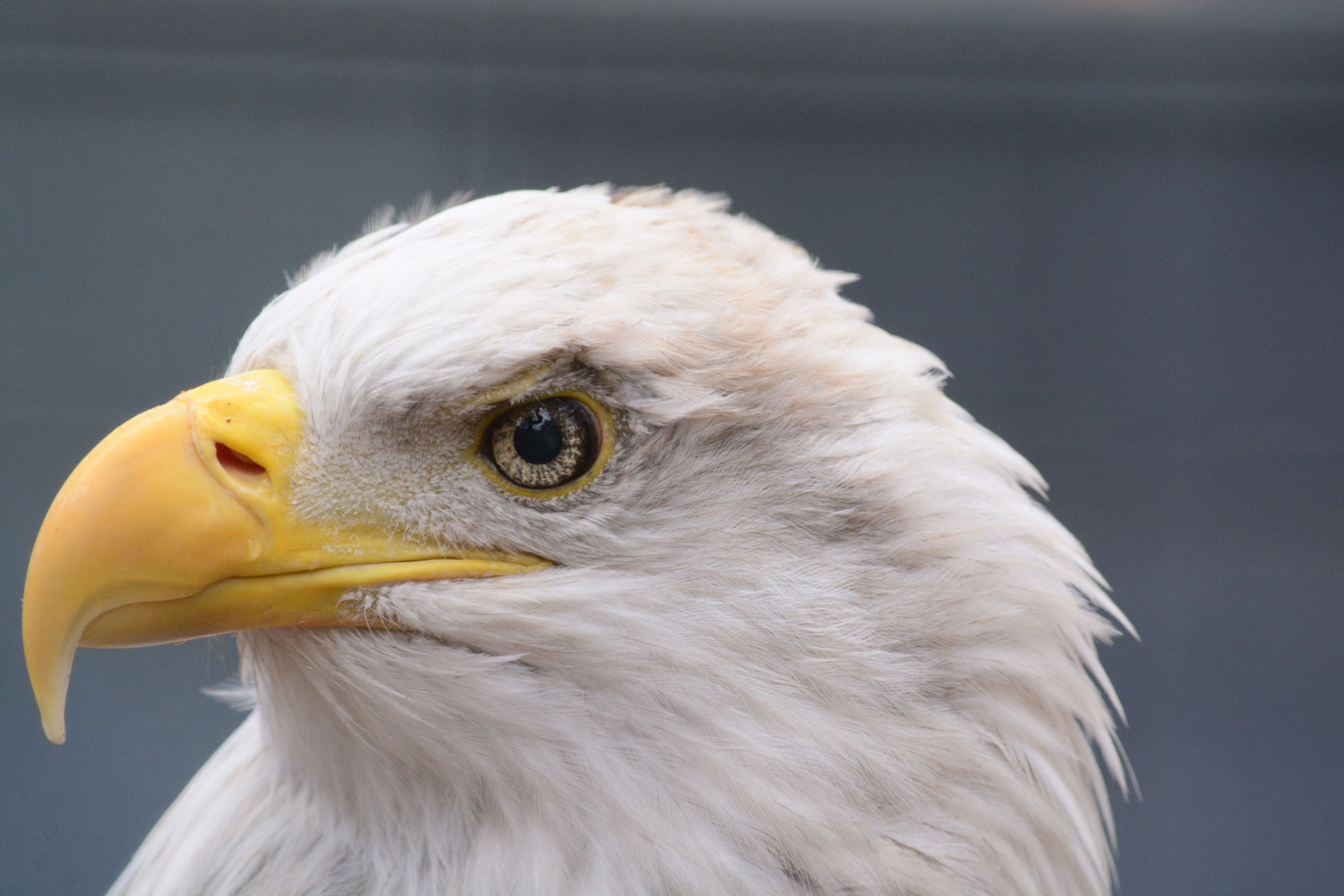
We checked out the animals pens. Mark photographed an American Bald Eagle and e-mailed me a portrait. It convinced me that I hadn’t taken the time to really look at this magnificent bird. His photo drew me to the eye. The iris is a sunburst of yellow bars. The pupil, black, and just above, the overhanging viser which gives the bird its fierce look.
Along our walk, I found nary a scrap of litter. I heard a helicopter and jet from nearby Gabreski Airport. Common crow calls were an unusual treat for me. In Babylon, where I live, there are few common crows. Fish crows just don’t have that throaty call of the common crow.
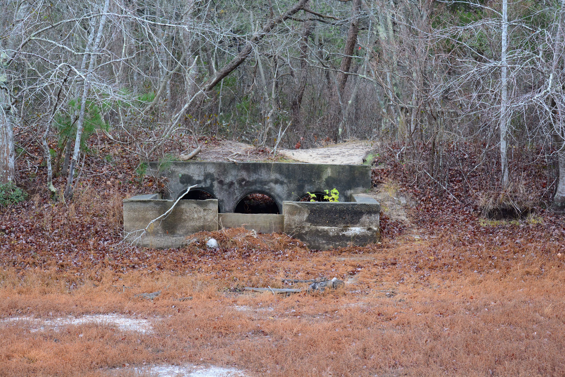
Although the water quality is good, an extreme drought condition has lowered the Main Pond. The North pond is dry. The edges are wet. I saw phragmites stalks marching in. The stand isn’t dense…yet. However it’s only a matter of time before it is. There is also purple loosestrife which is very aggressive along the edges of both ponds. I hope the drought ends soon or the upper pond will be crowded by tall reeds, a monoculture that has little to offer as a habitat for wildlife.
Because North pond was practically dry, Mark and I were able to explore the edges. There were plenty of deer tracks. This is a major watering hole, and the tracks indicate a desperation. The mud around one small puddle with water was completely tracked. There is a third pond to the north called Deer Pond most likely named as a drinking hole. I presume that the deer are now mostly drinking at the Main Pond.
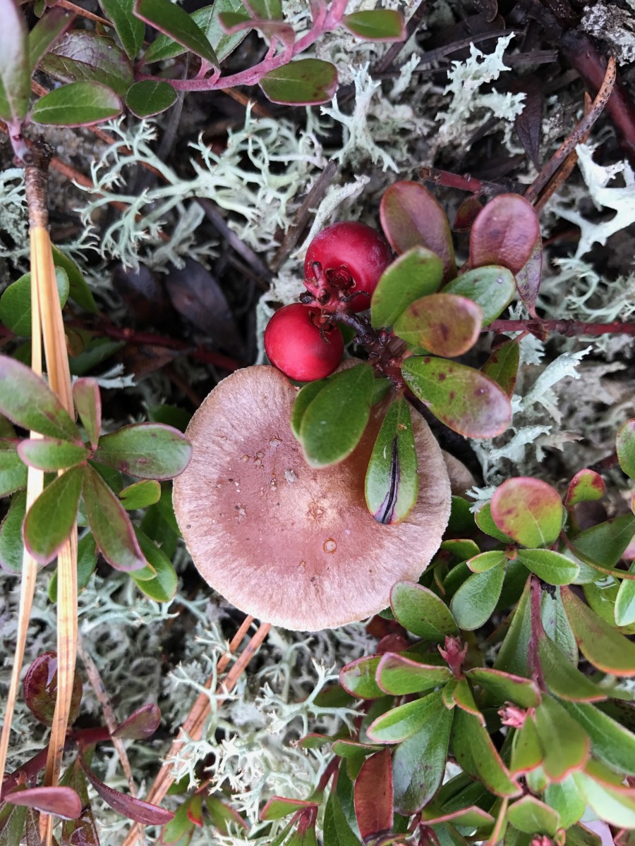
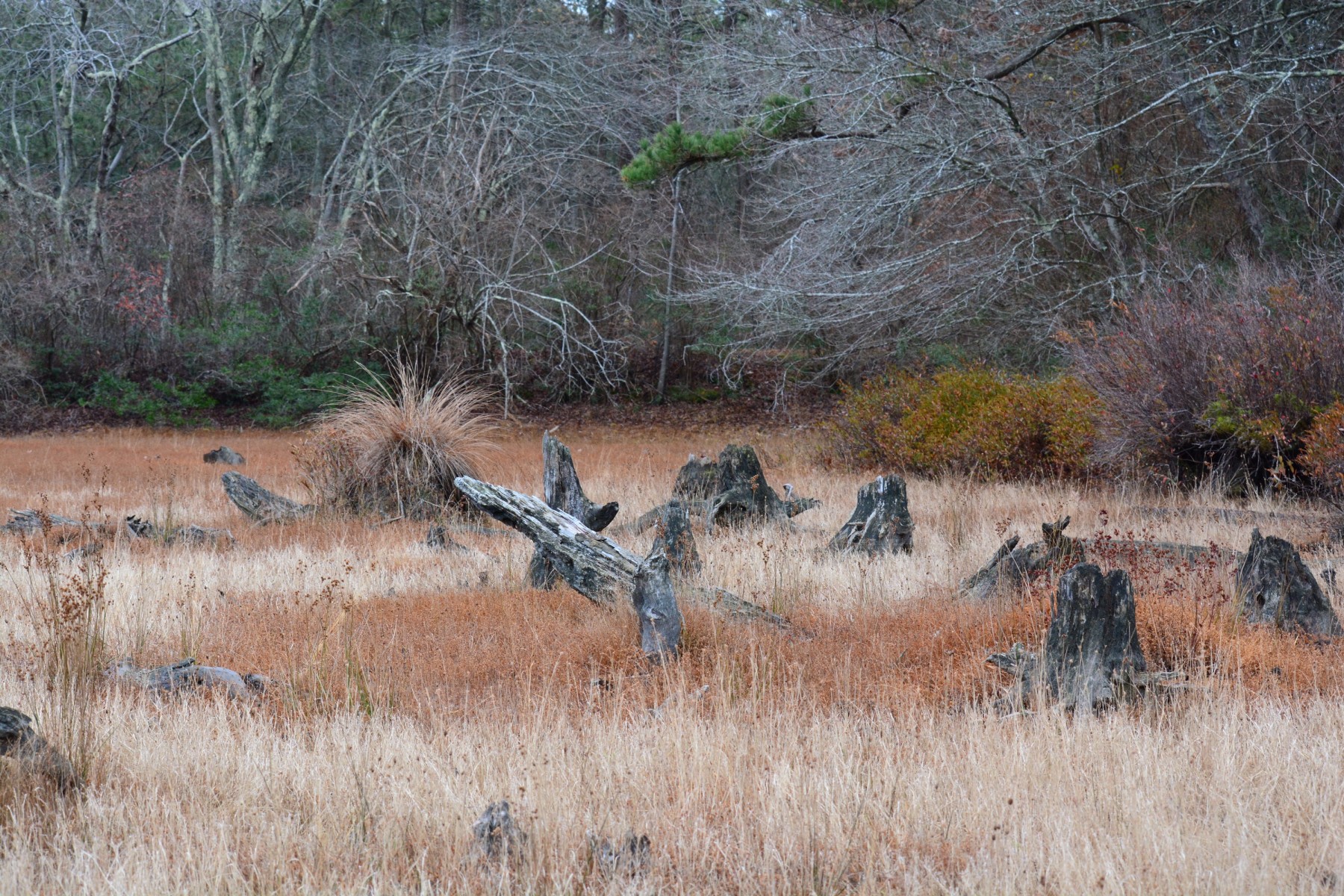
I discovered cranberry plants and a few cranberries at the north end of . We tasted them…tart and bitter at the same time, red drops of the Pine Barrens. Tussock grass hummocks stood out like columns with bunched hairdos. Tree stumps looked like staggering ghosts.
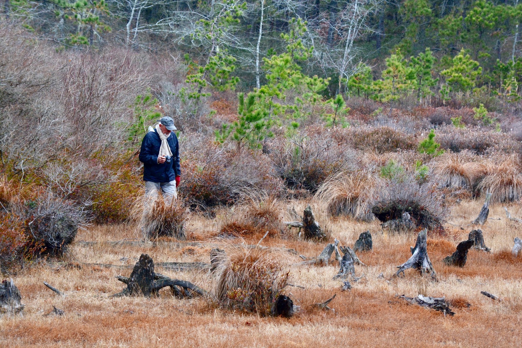
We decided to take the 3 mile long red trail, the longest of the three trails. Once past a giant caterpillar tunnel, we found narrow trails, alternately covered with needles and sandy spots with some straight as an arrow. The forest is almost totally Pitch Pine trees. Not much diversity except in pockets here and there. The trails are meditative, calming, and head off narrowing into nowhere. Walking here is peaceful and calming – and while not spectacular scenery, they conjure a feeling of security and safety.
We finally reached the fenced apex at the north end( who whole refuge is fenced). Bearberry vines with abundant lichens filled in spaces offered us charming groundcover textures. “There’s a mushroom, Tom” Mark offered. I quickly dropped to my knees to inspect. “Ah, finally a mushroom to take home to identify.” I carefully picked this brown mushroom and placed it gently in my pack.

IINTERMISSION
Back home on Black Friday in my studio with Mushroom ID book:
This unidentified mushroom had a dark brown cap, found partly submerged in sand “grows in sand” YES: in this case, under bearberry ground cover. The “gills becoming dark rust.” YES: Stalk club-shaped to bulbous; YES one to four reddish bands” AH,YES: I see a reddish band. Everything matches so far. Gills adnate ( wide apart) YES! I look on page 157 “Remarks: It is sometimes so deeply rooted in the sand that only the cap shows above it and all surfaces, but most particularly stalk and gills, are plastered with sand.” YES
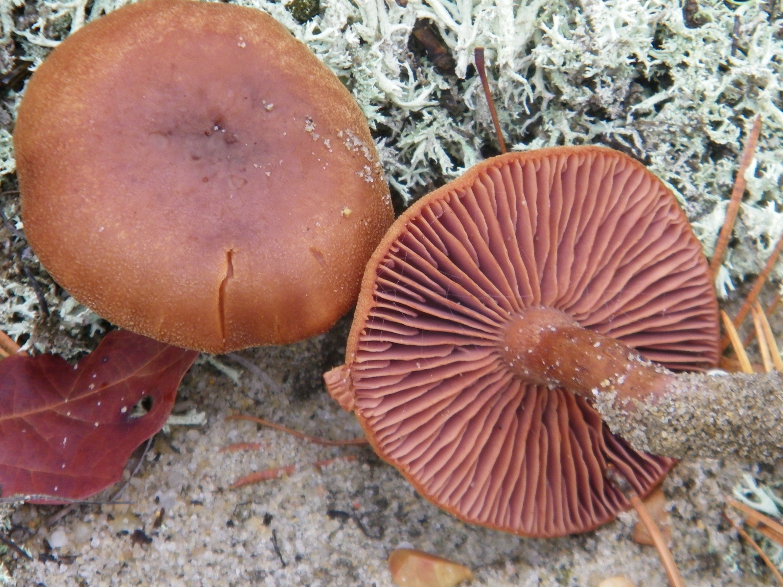
Sandy Tallowgill – Laccaria trillisata ; I’ve identified it, I’m positive: it’s on the list of over 700 Long Island mushrooms.
Mark and I continued on the red trail south along a fence. Pristine comes to mind, clean, untrammeled. Intermittant, which means that the freshwater portion of Quantuck Creek responds to drought by sometimes disappears depending on the height of the water table.
I’ll be back.
Tom Stock
Leave a Reply