Cupsogue is a strange name for a park. It sounds like a local Native American term. Wikipedia confirmed my suspicion. “…dated from the 1690’s, local Indians called it Cupsogue meaning “closed inlet,” A 1931 nor’easter opened it again and it was widened during the hurricane of 1938. I suspect that the location and narrowness of the barrier beach has caused it to open and close several times over centuries. Perhaps local Indigenous residents witnessed one of its closings.
The park is located at the dead end of Dune Road. It is fronted on three sides by water, the Atlantic, Moriches Bay, and Moriches Inlet. The inlet has been bolstered by two long rock jetty’s to curtail erosion. On either side, 15 foot high iron towers mark the opening.
After the beach goers leave, surf casters take their place. This is because there are fish and it is accessible. Mark invited me to spend the day at his trailer and to survey the area. He picked me up at the west end of the parking lot in his bulky Dodge Ram truck. He let enough air out his tires to become a beach buggy. I found myself bouncing around in the passenger seat due to deep ruts in the sand road. “The unaware often get stuck because they don’t lower the air pressure of their vehicles. This creates deeper ruts.” Mark navigated like a pro.
We arrived at his trailer which he uses as his base of operations in order to surf cast. We set up two chairs at a rise where a snow fence marked the edge of the trailer park. We sat facing the ocean with a strong southeasterly breeze lofting sand which sometimes stung my legs. What could be better than the simplicity of three uncluttered parts of this landscape? The viewscape is simple:The straight horizontal line of the horizon; snow fencing and dunes; the dome of clouds above. In my opinion, there is nothing better to offload the steam pressure of mainland Long Island life.
There is more oxygen here.” Mark was referring to the fact that Oceans generate most of the oxygen for the planet.In my opinion, the bay landscape seen here is much more interesting than further west. There is more texture. Two large dredge spoil islands were created here when the navigation channels was deepened. A string of green buoys shows a long, wide curve that power boats must use to avoid running aground. Moriches inlet tidal current ties in with the varied topography of the bottom of the bay creates cross currents that only seasoned boat owners should navigate.
The crescent-shaped archipelago is a sand bar that looks like a horseshoe. The color of the water attests to shallows and deeps. Mark witnessed a feeding frenzy with gulls and cormorants feeding on bunker. Later, when I looked at this island, I saw dark pinpoints of roosting birds who are taking advantage of the proximity of plentiful food. All this variety creates different sized waves and eddies. This all adds up to a very interesting bayscape.
Fishermen call a dark patch of water near the beach “The Hole.” Striped Bass like to hang out in holes. We watched a fisherman drift over the hole several times with no luck. Stripers enter the bay on an incoming tide and feed on bait fish, mainly bunker. Then they return to the ocean shore looking for bait there.
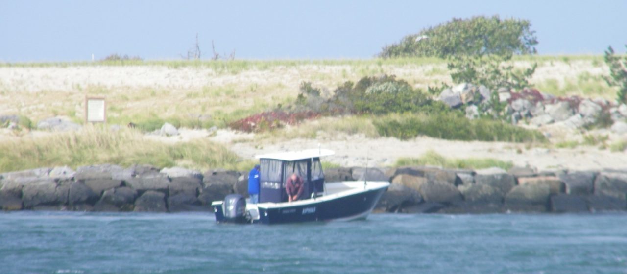
I decided to rest against a snow fence to enjoy the scene while Mark surf cast nearby. I sketched the two towers at the end of the Jetties and was mesmerized by drifting boats. They floated with motors turned off at odd angles, backwards or sideways, looking like they were in danger. Both shores are lines with dark gray boulders to prevent erosion. Perhaps these jetty’s will make the Cupsogue name obsolete.
We walked along the bay side heading back toward Mark’s camper. An odd scene of sand, tips of rocks and scattered eelgrass and litter liked like a photo of the surface of Mars. Mark saw small footprints on a small sand hill. We had seen a rat running along the jetty. They were rat footprints that looked a lot like miniature raccoon.
The sky was darkening and Mark decided to leave the camper and drive home. Mark takes lots of photographs and had thousands on the internet. I’d love to team up with him to create a book of my essays and his photos.
Near the exit to the parking lot, we saw two adults struggling to catch a gull. We decided to see what was happening. The gull had fishing line wrapped around its leg with a fishing lure attached. It was disabled. Mark crouched and teased the bird closer with bits of bread. It closed in, but not close enough to be captured.
During my visit, Mark surf cast camper as I snuggled under his sleeping bag. With three other county spots where campers are allowed, Mark has plenty of opportunities to surf cast. I hope I catches fish for all the time he spends with rod and reel.
Leave a Reply