While I taught science, I fell in love with the Nissequogue River, a few blocks from where I lived. Eventually I turned my enthusiasm into a book titled THE NISSEQUOGUE: A JOURNEY. As a naturalist, I started the project by exploring. This led to research and interviews, historical information, old maps, etc.
During one of my final teaching years, I had one horrible day in the classroom when everything went wrong. I recall a helpless feeling. During that moment, I imagined myself having a sail boat on the Great South Bay. This has come true and it opened up my curiosity about Sampawams Creek. The result has been a love affair, a David and Goliath story. This creek is an underdog and I love to root for the underdog.
I moved to Babylon Village after marrying Nancy Keating. She owns a home across the street from Sampawams Creek. I can see Southards Boat Yard from an upstairs window. One day, an old 1929 bay boat showed up in the yard. It had sunk in the creek. Mike, the owner, purchased it, rescued it, and restored it. I watched the process with interest While I was sketching the boat, that classroom dream kicked in.
Having sold my Manorville home, I was adrift and looking for volunteer opportunities to settle down and start a new life. The Long Island Maritime Museum, in Sayville was holding a new volunteer meeting to train crew to sail The Priscilla, a restored oyster boat. I signed on and joined the crew.
On the very first sail, I mentioned by dream to Mike, the captain.
“Talk to Tony.” I met Tony, told him I wanted to restore an old wooden boat and learn to sail. Tony gave me the phone number of Bill Madsen of Bay Shore. I called him. We met in his backyard and he showed me his wood pussy cat boat, circa 1960’s. “It needs work.” Without knowing what I was getting into, I bought the boat and trailer on the spot. Step one of my dream had come true.
Bill delivered the boat the next day. Roger, who lives across the street came over to see and talk to his friend Bill. We moved the boat into the garage and set it on blocks. I had heard that Roger was the go to. Roger is a master ships carpenter. Little did I know that he lived almost directly across the house.
I knew nothing about restoring a boat. However, Roger did. In fact, he likes to buy small shabby wooden boats and restore them in his shop around the corner. Roger lived right on the creek, has a bulkhead and gear to launch small boats.
“You’ll start by replacing the deck.” Step by step, for several months, I slowly followed Rogers suggestions to get the boat ready to launch. He teased me several times about my awkward skills. My excitement built with the expectation of actually achieving my dream.
With the launch of the boat, I had my first contact with Sampawams Creek. Roger towed me down to slip #69. I now had a boat on brackish water less than a half mile from the bay. I was only a 15 minute walk from house to slip.The stage was set for my sailing education.
From the very first time I left the slip, I began to wonder about the whole creek. Roger lives a short distance from the underpass where the creek flows under Montauk Highway. Boats from Southard Boatyard and had slips there. Where did the water come from? I had seen Hawley Lake and falls. Curiosity led me to want to know as much as I could learn. I am a naturalist interested in botany, geology, fauna, impacts, and history. Learning to sail became a subset of knowing the whole story.
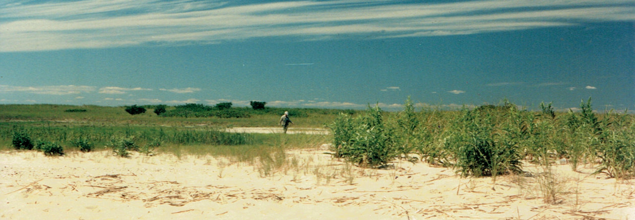
At the bulkhead, I noticed a plant growing right out of the wood. I broke it off. The leaves looked spinach leaves. It is called Sea Beach Arach, a plant that lives at the edge of salt marshes. How did this plant, which grows in sand at the high tide line of salt marshes, end up on the bulkhead? I looked closely and found the answer. The vertical wood slat was cracked. The plant lodged itself in the crack having floated here at high tide.
An 1875 coastal map was a great revelation. It showed me an entire different idea of what Sampawams Creek estuary looked like 140 years ago. This map has cross-hatching with little plant markings along the edges of the creek banks as well as a large part of Sampawams Neck. This was salt marsh habitat. This habitat has cord grass growing extensively. This is habitat for fish eggs, crabs, snails, and shellfish. The map shows what an estuary is…an indentation in the edge of a marine shoreline that has a creek, stream, or river flowing from up land elevations to sea level. As fresh water mixes with salt, the salinity of the water goes from low to high. Salt water from the bay flows into the creek twice a day. The tidal range in Sampawams creek is about three feet. At the time this map was drawn, the clarity of the water was pristine. There were no outboard motors to disturb the sandy bottom.
Sampawams Creek was not always an estuary. Sea level rise about 5,000 years ago raised sea level to what is not the bay. Before there was a bay, there were no barrier beaches. As sea level rose, sand from bluffs at Montauk Point began migrating west and depositing. Slowly, Fire Island was formed and the bay thereafter. Salt water began to creep up the creek. This changed th ecology from fresh water habitat to brackish. Soon after, a whole host of marine organisms congregated at the mouth of the creek. The water carried lots of nutrients that started fod chains which led the the flourishing of plankton, clams, marine worms, crabs etc.
Fish found the creek a good place to feed. The estuary, full of nutrients which start food chains and more complicated food webs. The twice a day tides added to the nutrients making the estuary like a food pantry. Blue fish, menhaden, sea run trout, white fish, ( and others) killifish, silversides, and many more species used this as their nursery. The stalks of cord grass provided shelter. Hermit crabs skittered along the high tide line.
Shellfish thrived in the creek. Oysters, scallops, mussels, were abundant. Blue claw crabs are still there. From the town dock, I see eight floats attached to crab traps. A local fisherman brings his boat and checks each trap weekly. I saw him emptying crabs from my little boat in Babylon Cove.
Birds found the creek a feeding ground. Egrets, herons, osprey, skinners, ducks, geese, gulls, terns, swans, are integrated into a complex, vibrant ecosystem.
At that time, there was no bridge over the creek on South Country Road, now called Montauk Highway. Travelers on horseback or carriage, forded the creek. The banks along both edges of the creek were mud. Lewis Basin was a salt marsh cove.
Today, Swampawams creek is better described as a canal than a creek. It is still an estuary, but it is a severely impared body of water. Its demise began long ago. Early on farmers on Sampawams Neck began closing in on the salt marshes. Filling has continued since then. Sampawams Neck was a very desirable place to build a house. Until there are no natural salt marshes left. Sail boats rested on the fertile mud banks. This itself changed the ecology. Soon, foot traffic and increase in the number of boats led to bulk heading. Today, almost the entire creek is bulk headed. There are only three or four sandy beaches on the West Islip side that have sandy launch ramps. Instead of a gently sloping horizontal slope along the edges of the creek, incoming tides slide up and down vertical bulkheads. They offer very little opportunity for the filtering process that occurs as flood and ebb tides “clean” the shore bringing in new nutrients and providing places for wildlife to live.
The Southside Signal printed a news account of houseboat pollution in the early 1900s. Several families were living in houseboats tied up along the creek. Raw sewage and waste water was dumped directly into the creek.
Here is South Side Signal, October 3, 1919:
MORE ABOUT EAST CREEK
Village Board hears formal complaint as to houseboats polluting the Sampawams. Definitive action deferred.
Today, there are almost 300 boats in slips along the creek. Most likely, minor spills of oil and gasoline occur. I’ve seen oil slicks on walks and sailing. I myself have accidentally dropped tools into the creek. There are dozens of drainage grates on streets adjacent to the creek. Rainwater is carried into the creek through pipes. Many of the grates have the silhouette of a white fish near the grate warning that chemicals can find their way into the water. I see boaters cleaning their boats with detergent and then rinsing. The creek receives runoff water all along its course up to Deer Park. Runoff water finds the lowest place to flow carrying residual pesticides, herbicides, fertilizers, and other toxic products into the water. I linoleum tile factory on Bay Shore Road emptied chemicals into the creek. The result of this was a massive fish kill in Deer Lake. The long Island Railroad washes its cars close to the creek. Some of the waste water made its way into the water. The Railroad has since stopped this.
Another problem that lasted at least a decade was silt runoff from housing construction upstream. The silt overflowed the dam at Hawley lake and deposited opposite Southard Boat Yard. Boat navigation was impacted.
Dredging of Lewis Pond to create a bulk headed marina removed the last patches of salt marsh on the creek. A former clammer told me that he remembers that “the water was clear and you could see the bottom” Today, the water is cloudy. Nitrates from upstream have helped algae growth. The constant supply of algae from the creek end up in the estuary and cuts down on the clarity of water. Mud stirred up by outboard motors adds to this. The flushing of the tides doesn’t help because the Bay Is cloudy as well. The abundance of clams, oysters, and filter-feeding scallops cleaned the water of microorganisms back in the 1950’s. With the demise of much of the shellfish, the water column is not as clear as it was 65 years ago. A state regulation tells clammers to harvest fifteen hundred feet away from the shore. Our Native Americans harvested shellfish right in the mud where the public Town dock is today.
I talked to a man who runs the fishing station next to Degarmo’s marina. He sells gas ($3.55/gallon), and operates the pump out station. “Boaters are serious about not polluting the bay or creek more than it already is. I think this is progress, but we have a long way to go.” I charge boaters $8 to empty their tanks.” What kind of fish are caught off the docks? Iasked. “Now it’s blowfish.” He also has a small tackle and bait station with an ideal location and easy for boaters to stop. I asked about clam boats. “I can set my watch by two clam boaters that pass by at 6AM every morning.” These two harvesters are the last remnant of a once thriving generation of clammers that made their living just a mile from the mouth of the creek.
Sampawams creek is part of the South Shore Estuary Reserve. Their mission is to protect and improve the Great South Bay. Keeping tabs on the major water supply to the bay goes a long way toward prescribing necessary improvements. Fresh water runoff from at least 50 creeks feed the bay. Their health is necessary. Many creeks like Sampawams have similar problems. The South Shore Estuary Reserve collects data, makes recommendations, and pushes for improvements.
Boaters lucky enough to secure a slip rental have access to the bay and Fire Island Inlet which is where the fish are. The inlet is the main source of ocean water for the bay. Incoming tides bring in various species of fish all year. We are all lucky to have the Sampawams Creek Estuary. Joggers, dog walkers, pairs of people out for a friendly walk all enjoy the maritime scenery that the creek, cove, and bay have to offer.
Marq Wells
Very Good TOM ! ! !
Andy
An organic way to learn sailing. Rebuild a boat and take it out!
Diane Lundegaard
Thank you for the historical and contemporary view of Sampawam Creek. What remains is still as beautiful as important and warrants our protection. Congratulations on the restoration of your sailboat!
Diane Lundegaard
Loved seeing the pictures of the old maps pertaining to the area that you posted